#Story
Landfront Vlissingen bunkers
A cycle path connects West-Souburg with Middelburg. Leaving from Souburg, one first encounters a small square bunker. This was a telephone exchange post that connected the bunkers of the Landfront with other positions within the fortress (Verteidigungsbereich) of Vlissingen.
At the next bunker, the waterway makes a bend and becomes a former tank ditch. On either side of the ditch stand machine-gun bunkers of type 630. The tank ditch originally bent north at this point, but this section has since been filled in. Continuing along the route, one reaches a gun bunker for a mobile anti-tank gun (type 625). From this bunker, the cannon controlled the bridge over the tank ditch.
Crossing the Abeelseweg, two more type 630 bunkers are visible. One was constructed using wooden formwork, the other with concrete blocks (Formsteine). Here, the tank ditch originally ran toward the Kanaal door Walcheren, but this section has also been filled in. Continuing the road toward the canal, a tank obstacle can be seen along the Vlissingseweg. This consists of reinforced concrete “dragon’s teeth,” known to the Germans as Höckerhindernisse. A tank ditch was not geologically possible here. The barrier extended to the canal dike, but this section has disappeared due to infrastructure improvements.
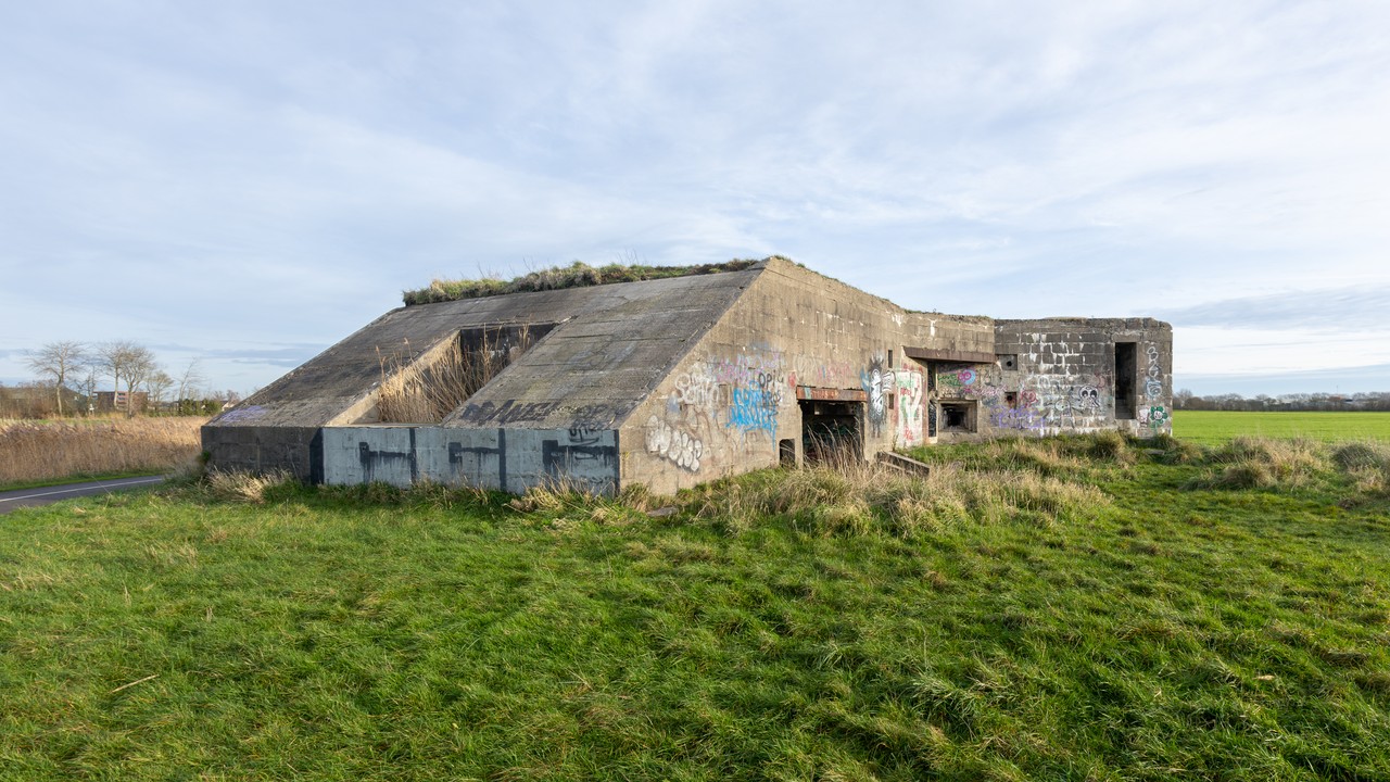
Behind this is a bunker (type 629) where an anti-tank gun could be stationed and the crew was accommodated. The defence was conducted from prepared positions in the surrounding area, rather than from the bunker itself.
Continuing along the service road toward Vlissingen, at the corner of the Abeelseweg intersection one encounters a crew bunker (type 621) for ten men. During the war, this bunker served as a company headquarters. Immediately after completion, the bunker was camouflaged as a house by painting windows on the walls and adding a pitched roof. The Bunker Preservation Foundation has since restored this camouflage.
Continuing along the road toward Vlissingen, after more than a kilometre, the Steengracht in West-Souburg can be seen — a waterway that, in early 1942, served as a tank ditch for the fortress of Vlissingen before being expanded into its final form.
This brings the route back to West-Souburg, completing the loop.