#Museum
Atlantikwallmusem Hoek van Holland - icon along the Nieuwe Waterweg
The mouth of the Nieuwe Waterweg forms the gateway to the world ports of Rotterdam. To defend it, an impressive armored fort was built in Hoek van Holland in the 19th century. During World War II, the ports were of great importance to the German war industry, and the Germans transformed a large area around the village into a Festung. Behind a kilometers-long double tank ditch, the largest concentration of bunkers in the Netherlands was built.
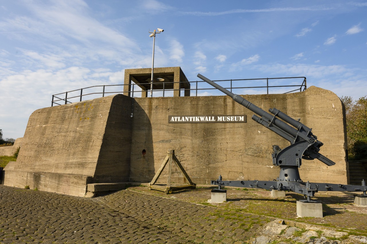
It is enjoyable to walk along the busy Nieuwe Waterweg. At the start of the Noorderhoofd, better known as the pier of Hoek van Holland, the Atlantikwall Museum Hoek van Holland is housed in a large gun bunker. At the time, the cannon covered the shipping route. After the liberation, the bunker was used by the Royal Netherlands Navy as a radar station, which is still recalled by the distinctive concrete radar structure on the roof.
The bunker also marks the start of a two-meter-thick anti-tank wall running parallel to the pier. Several meters are visible before the wall disappears under the dune sand. Further along the pier, the wall made a bend to the north and extended for about one and a half kilometers along the beach, parallel to the Strandboulevard toward the Zeetoren. Multiple gun bunkers were built into the wall. Allied troops arriving on the beach with landing craft would encounter the wall and could not advance while German machine guns, mortars, and cannons continued to fire on them.
After the war, a small section of the wall was demolished to allow access to the beach via the Badweg, where you can see the wall disappear under the road on both sides. At this spot is also “Bunker 2,” a gun bunker that is also part of the Atlantikwall Museum Hoek van Holland.
The landscape in Hoek van Holland has changed dramatically since World War II. On the north side of the Nieuwe Waterweg, large amounts of sand were deposited, creating a new dune landscape and moving the beach about 800 meters west of its World War II location. The bunkers are no longer seen in their historic spatial context. The Strandboulevard now only retains its connection to the beach in name, and the pier has become a walking promenade.
On the south side of the Nieuwe Waterweg, you see industrial and port areas where the internationally renowned bird island De Beer once lay. Here, the Germans built most of the bunkers in the Netherlands and stationed the heaviest artillery. The three guns of the Marine Küsten Batterie Rozenburg, with a caliber of 28 cm and a range of 42 kilometers, could fire on enemy ships in the North Sea and inland as far as Leiden or Zwijndrecht.
The area filled with abandoned bunkers remained a dynamic dune landscape with wide beach plains until the 1960s. Afterwards, the island of De Beer was completely excavated (and disappeared) to make way for the rapidly expanding Rotterdam harbor and industry. Oil refineries and container terminals were established between the city and the beach. With the loss of this unique natural monument, all the bunkers in the southern part of the former Festung Hoek van Holland also disappeared.
Opening hours:
From April 2026 open on several Sundays 12:30–17:00.
Please check the official website for the most up-to-date visiting information and opening hours.