#Landmark
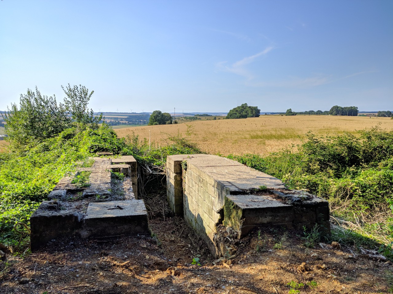
Mont Gournoy - V1 launch base
The V1 site at Mont Gournoy, in the commune of Rétonval, was built between February and March 1944.
A first-generation V1 site, the work took place on Mont Gournoy between February and March 1944. Soviet prisoners were partly involved in the construction of this so-called ‘modified’ (or ‘light’) base.
Compared with the ‘heavy’ sites, which included a dozen or so concrete structures needed to deploy and fire the flying bombs, the organisation of this type of base was simplified. The number of concrete buildings is limited, and concrete is sometimes replaced by temporary wooden structures, which are quicker to build and less expensive.
Located on the edge of the forest, the site benefits from exceptional natural camouflage. At the beginning of June, the equipment needed to deploy and fire the flying bombs was brought to the site.
A very active site from the start of the offensive, but ineffective.
From the night of 12 to 13 June 1944, the Mont Gournoy site became active, taking part in the first salvo of the entire V1 offensive. Although very active, the base was characterised by inaccurate V1 fire and flying bombs fell repeatedly in the surrounding countryside, frightening the local population and sometimes causing civilian casualties.
The base was spotted by the Allied air force at the beginning of July, and several bombing raids were carried out in an attempt to neutralise it. At the beginning of August, the Allied air raids finally achieved their objective: the position was no longer in use.
The base was spotted by the Allied air force at the beginning of July, and several bombing raids were carried out in an attempt to neutralise it. At the beginning of August, the Allied air raids finally achieved their objective: the position was not destroyed, but the damage was too great for the Germans to undertake rapid repairs. They dismantled most of the equipment, including the launching catapult, and left the site in mid-August.
You will find a map showing the remains of the V1 launch base at Rétonval (Mont-Gournoy), as it existed between February and March 1944.
Created by Mr. Yannick DELEFOSSE using IGN maps, field surveys, and archival documents, this detailed map makes it possible to identify the various structures of the base (reception platforms, firing bunker, technical shelters, etc.) as they existed in 1944. Structures shown in purple represent those that were destroyed during, or as a result of, road realignment work carried out in 1977.