#Landmark
Val de l'eau - V1 launch base
The Rieux launch base belongs to the third generation of ultra-simplified sites.
The Val de l'Eau base, located in the commune of Rieux, is a third-generation ‘modified’ or ‘light’ launch site. Compared with the ‘light’ site of the previous two generations, its layout is even more minimalist.
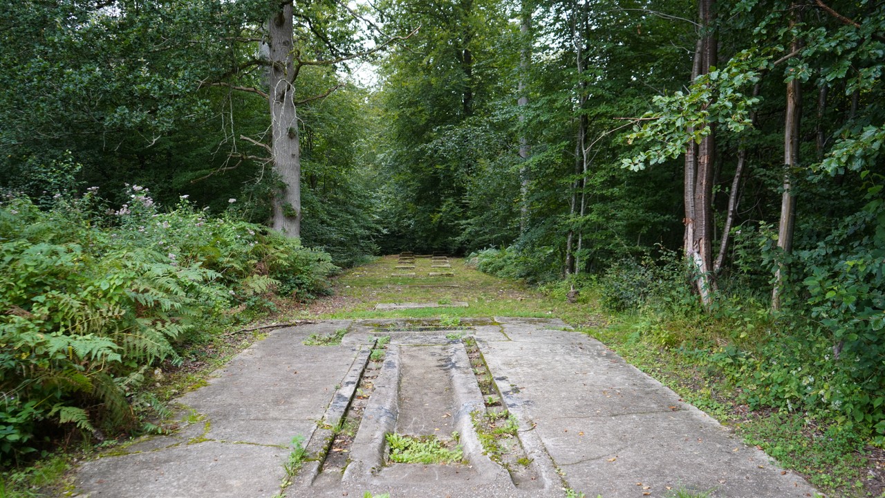
However, it is distinguished by a long, straight access track, the ‘Stellfläche’, which is used to store V1s awaiting preparation. Simplification is taken to the extreme, as this type of base comprises just one building: the firing bunker. The entire process of deploying a V1 is therefore carried out without any permanent structures. With the exception of the firing bunker, concrete was used here only for ground works: concrete paths for driving around the site, a water tank and a non-magnetic platform. There is a partly sloping preparation slab for the drainage of rinsing water. In addition, on the highest part of the site is the non-magnetic
slab without its guide rails, a characteristic feature of these ultimate sites. Built in secret, in the heart of the Eu forest and far from any habitation, the Val de l'Eau site was not spotted until after the Liberation. Its target was the city of London, 211.7 kilometres away. At the time, no documents or information, in particular aerial photographs taken by the Allied air force, could be gathered about this V1 base because it was so discreet.
You will find a map showing the remains of the V1 launch base at Rieux (Val de l’Eau), as it existed in 1944.
Created by Mr. Yannick DELEFOSSE using IGN maps, field surveys, and archival documents, this detailed map makes it possible to identify the various structures of the base (reception platforms, launch ramp, technical shelters, etc.) as they existed in 1944, as well as their precise location within the current landscape.