#Fortification
German defences & radar
The cliff top positions in the area to the west of the city offered the Germans a vantage point to observe out across the Bay of the Seine and the English Channel. This position was used for both a battery position and a radar site.
This stretch of the cliff area that towers over the shingle beaches below gave the tactical advantage for the German defences to be created in this area. Firstly, for defence of the area from any naval approaches. Secondly, the high flat ground would be used to install the German radar systems for detection for approaches by air or sea.
To the northern side of this coastal area is the former French Napoleonic fort called ‘Dollemard’. This is more commonly known now as the Batterie Dollemard. This consisted of two large open gun platforms, billets, and a fire control post. The old fort had been turned into a battery by the occupying Germans and then expanded.
Two large guns on open platforms were capable of 360-degree fields of fire. But the intended purpose was to fire out to sea and on to any approaching allied shipping.
The fire command post sits on the edge of the cliff and would also be used for observation purposes to direct and adjust fire from the two guns that were positioned here. Other concrete bunkers are now closed off, but were used for storage and billets for the personnel positioned here.
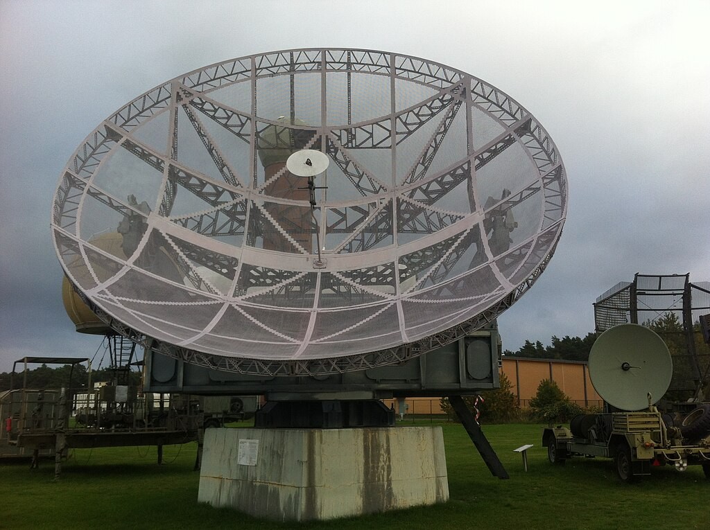
To the southern part of this site is the German radar site facility. Numerous large concrete structures formed part of this site.
The largest radar on this site was the FuMO 5, Wurzberg system. This could detect allied aircraft of naval vessels between 40km-50km in distance away from Le Havre. This radar system was also supplemented by the smaller Freya system.
The Freya system, though smaller in size, was a more modern advancement. This had a range of detection up to 200km in distance and was an early warning system.
The third large structure on the site was used for personnel, operated by the Kreigsmarine (German Navy).
When visiting this site, it is strongly advised to remain well back from the cliff edges and not to enter any of the concrete positions.